Orthographic Projection
It might be argued that the first Orthographic Projection was the sundial. It does, after all, trace a 2-D rendering of the sun's 3-dimensional route across the sky. So the first use of this construct was not to map space, but rather to map time. Obviously, this is not a new idea. But let's stick to the spatial representations.
To understand a three dimensional object or space, it is often necessary to have more than one view of it. Vitruvius suggests that three views are needed to express the designer's intention:
A groundplan is made by the proper successive use of compasses and rule, through which we get outlines for the plane surfaces of buildings. An elevation is a picture of the front of a building, set upright and properly drawn in the proportions of the contemplated work. Perspective is the method of sketching a front with the sides withdrawing into the background, the lines all meeting in the centre of a circle.
In (likely) 1474, Piero Della Francesca published his treatise on drawing, De Prospectiva Pingendi.
He clearly shows a method for rendering several different views of the same object: What we would now refer to
as Left Elevation, Front Elevation, Plan and Section. The relationships Piero established are still the most widely
used form of technical drawing today. Orthographic Projection allows for the very detailed and accurate renderings.
So the method was quickly adopted by mapmakers, shipbuilders, architects, engineers and stage designers.
The protocols would be formalized by Gaspard Monge in 1795 as Descriptive Geometry.
Immediately after Columbus' 'discovery', and certainly long before the entire world was properly surveyed,
mapmakers were using various Orthographic configurations to create a flat map of both the known and the imagined world.
This is Cornelius de Jode's polar projection. Londitudes are rendered as straight lines radiating from the poles.
Latitudes are rendered as circles. At first glace it resembles the Six-Point projection we discussed earlier.
There is however one major difference: Six-Point Perspective assumes the observer to be at the centre of the sphere.
In De Jode's projection, the viewer must be outside the sphere, somewhere above either the North or South Pole.
Gerardus Mercator's projection renders the naturally curved lines of latitude and longitude as straight lines.
This makes it easier for sailors to plot a course using stright lines. The major flaw is that the areas around
the north and south poles are impossibly distorted. Nonetheless this is still the map we use most often today. Antonio Scamozzi's Ground Plan and Section for the Teatro Antico in Sabbioneta accurately describe the building, and interestingly
show the scenery constructed and painted in Perspective to create an Anamorphic Forced Pespective.
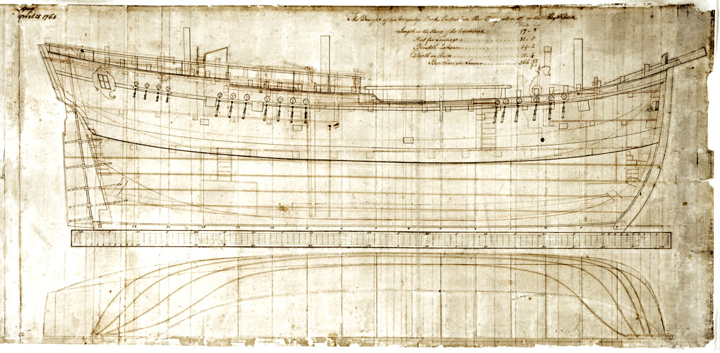
Captain Cook's famous ship HMS Endeavour was designed in 1768. The drawings were accurate and detailed enough
to allow the ship to be reconstructed in 1993.
But Orthographic Projections are artificial constructs. They require belief in the system to be able to interpret them.
The orthogonal lines do not converge, or rather, the point of convergence is infinitely far away. So if we relate this
to one point perspective, then the viewer must be infinitely far away from the object. But at the same time the viewer is able
to see the minutest of details. Add to that we can see all sides of the object at the same time. In other words, the viewer
is omniscient. It is certainly an arrogant notion, but Orthographic Projection is an excellent method for developing a design
or for exploring some very complex spatial concepts.
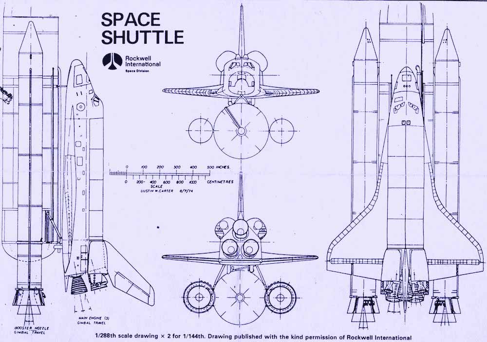
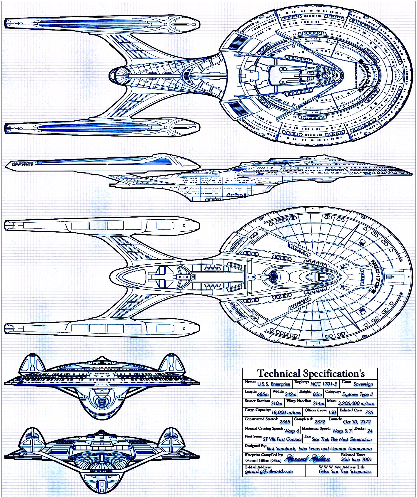
And of course is also an excellent tool to accurately communicate the concept. This is particularily important for large projects that
require many fabricators, all of whom must work toward the same goal. Our faith in thse drawings is so strong that when they are used
to estimate costs of a project, or to request construction permits, they can actually become legal documents. So, arrogant or not,
Orthographic Projection has allowed designers to achieve some impossible results.
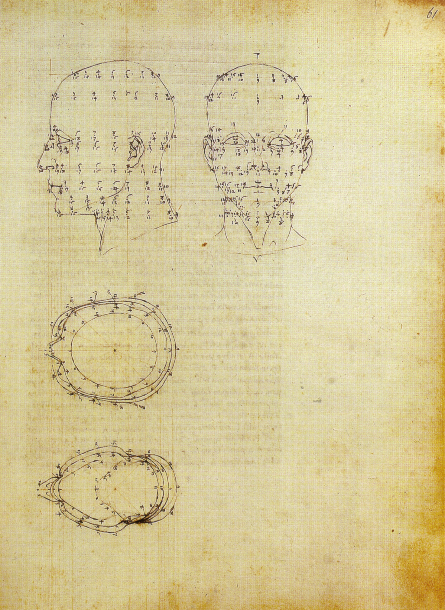
Piero Della Francesca: De Prospectiva Pingendi. 1474
Museo Galileo.it 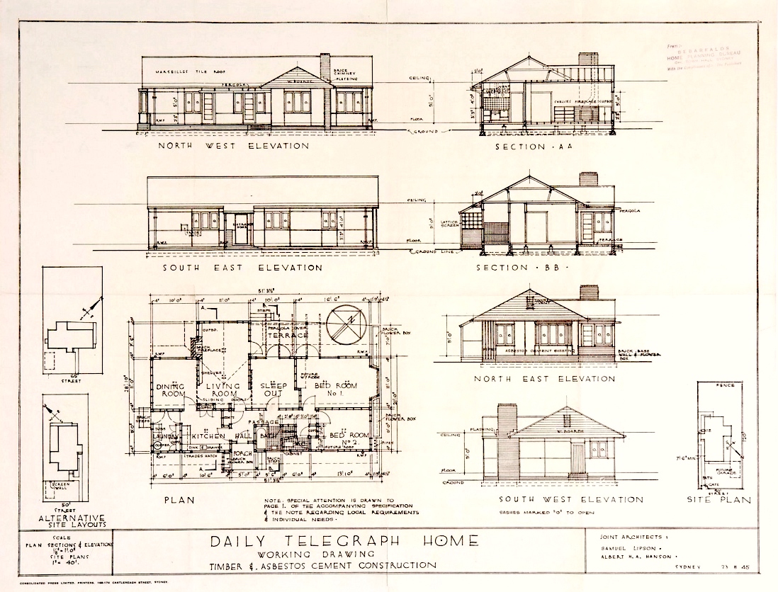
Samuel Lipson, Albert H.A. Hanson: Daily Telegraph House 1945
Sydney Living Museums
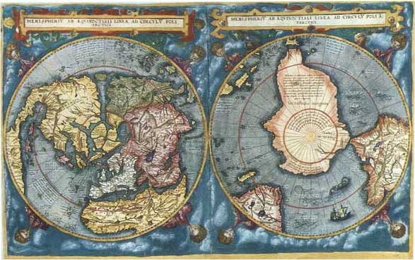
Cornelius De Jode: Hemispheriu Ab Aequinoctiali Linea, Ad Circulu Poli Arctici et Poli Atarctici 1593
sanderusmaps.com
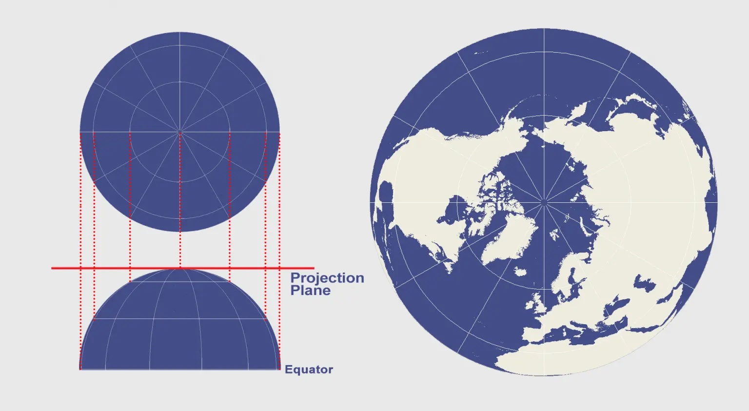
gisgeography.com
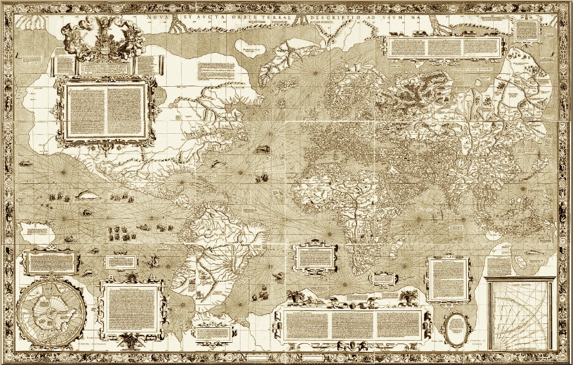
Gerardus Mercator: Nova et Aucta Orbis Terrae Descriptio 1569
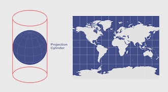
gisgeography.com
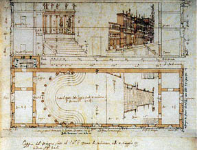
Antonio Scamozzi: Plan for Teatro Antico , 1588, Sabbioneta
https://www.acsa-arch.org/proceedings/Annual%20Meeting%20Proceedings/ACSA.AM.99/ACSA.AM.99.5.pdf
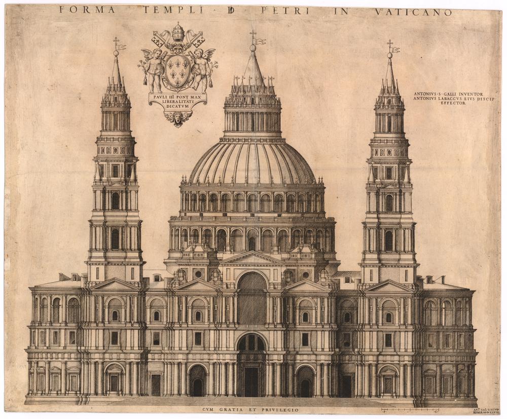
After Antonio Sangallo: Forma Templi D. Petri in Vaticano (Facade), 1547
https://www.britishmuseum.org/collection/object/P_1920-0420-61
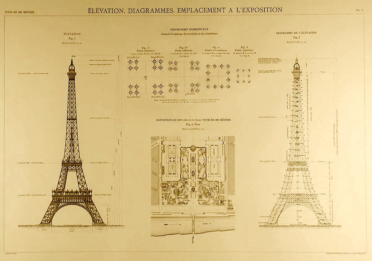
Gustave Eiffel: Tour de 300 Metres, 1887, Paris
https://commons.wikimedia.org/wiki/File:Eiffel_Tower_plans_01.jpg<
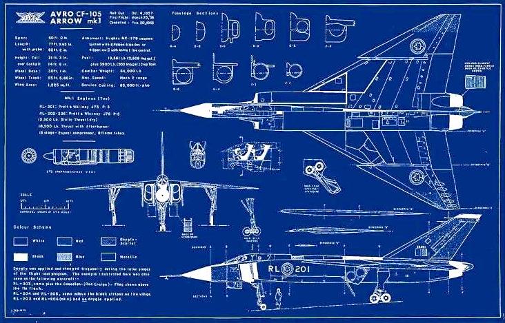
https://www.warplane.com/gift-shop/Prints-by-Jeff-Stephenson/avro-arrow-blueprint-poster.aspx
